
Drones make inspections in GPS-denied areas possible
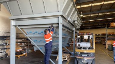
In order to conduct inspections in tight spaces, such as Boilers, Vessels, Tanks and Structures, scaffolding or rope access is recommended. However, this can be a time-consuming and costly exercise. Besides, there is the risk of exposing personnel assigned for inspections to hazards.
Alternatively, using its Elios technology, Steinmüller Africa offers autonomous inspections in areas where GPS signals cannot be picked, and eliminates the use of scaffolding or Rope Access. It has clientele in diverse sectors across Africa.
By Jimmy Swira
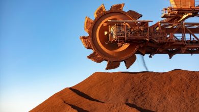
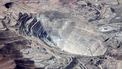
Ideally, mines expect the drone services they procure for safety and maintenance, inspections, and post-incident investigations in all environments to operate smoothly: delivering data as and when needed. However, the reality is different: frustratingly, most GPS-guided drones on the market fall short in complex, confined, and dangerous spaces – particularly around buildings, structures, and other landmarks – not delivering at all.

This is a problem that Steinmüller Africa has ensured that its Elios technology addresses, as two of the company’s technical team, Fanie Smuts and Carel van Aswegen, assure mining operations.
Challenges with GPS-guided drones
To underline the relevance of Steinmüller’s Elios technology, first demonstrate the challenges with GPS-guided drones when deployed in tight spaces. Van Aswegen: “When inspecting certain mining areas for safety and maintenance purposes, particularly where there are buildings, structures, and others, the GPS signal cannot be picked. The loss of signal has significant implications: the drones would then not be able to locate its current position. This could result in the loss or damage of the drone.”
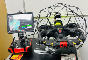
Steinmüller’s Elios Drone Solution
In addressing this challenge, Steinmüller’s Elios drone solution does not make use of GPS coordinates as a navigation tool. Instead, it employs an optimised radio frequency, FlyAware SLAM Engine, and LiDAR mapping software to track and see surroundings, as well as for its autonomous ‘Return to Home’ function.
Enabled by a Wide Range of Features
Smuts points out that the Elios drone is able to function effectively in such a challenging environment due to the wide range of features and technologies it incorporates. Specifically, these include but are not isolated to:
- Built-in: Visual inspection payload
- Add-Ons: UT, Surveying, RAD, Flammable Gas Sensor
- LiDAR-based Stabilization
- Live Situational Awareness
- Location-Tagged Data
- Collision-Resilient
- Confined Space Access
- GPS-Denied Flights
- 4K Camera (Built-In):
- Sensor: 12.3 MP, 1/2.3″ CMOS
- Video Resolution: 4K / 30 fps
- GSD Resolution: Up to 0.18 mm/pix
- Focal Lens: 2.71 mm
- FOV: 180° Tiltable Camera Pod
- Thermal Radiometric Camera:
- Sensor: Lepton 3.5 FLIR
- Resolution: 160 x 120
- Accuracy: ±5°C or ±5%
- Frame Rate: 9 fps
- Thermal Sensitivity: ≤50 mK T
- Lighting System:
- Light Output: 16,000 Lumens
- Modes: Normal, Dustproof Lighting, Oblique Lighting
- Surveying Payload (Add-On):
- Sensor: Configuration Ouster OS0 128 Beams REV 7
- Accuracy: From 0.1% Drift
- Precision: 1σ +/- 6 mm, 2σ +/- 12 mm
- Range: Up to 100 m
- Scanning Rate: 1.3 M pts/sec
- Photon Sensitivity: 10x
- Handheld Functionality
- In Post-Processing:
- Software: FARO Connect (Partner Solution)
- Features: Data Alignment, Georeferencing, Point Cloud Filtering
- Export Formats: LAZ, LAS, E57
A Wide Scope of Services
Using this revolutionary technology, Steinmüller Africa currently offers confined space inspections for areas where scaffolding or rope access would be required. This is in Boilers, Vessels, Tanks and Structures.
Worth mentioning, the drone can be flown in areas where a permit for entry is not yet issued, meaning time for inspections is significantly reduced. This makes it up to the task, stresses van Aswegen:
“The drone cuts cost and time significantly.”
Steinmüller is always eager to increase the scope of solutions offered to clients. Currently, it is busy working with software that is compatible with the drone software, in aim to provide services like stock yard measurements and detailed 3D mapping of components to be able to measure location deviations, etc.