
WrittenBy : Precious Chiurunga; Freelance Writer
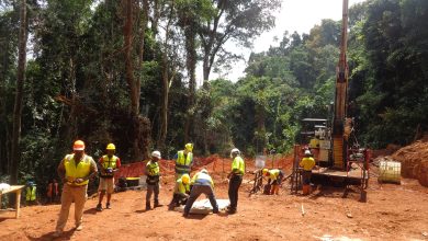
The niche of Airborne Electromagnetic (AEM) in airborne geophysical surveys for geological Mapping and exploration is set to grow in 2024. With previous experience working in the region, coupled with potent airborne systems, Spectrem Air has the strategic advantage of previous experience working on projects in Africa.
Spectrem Air is looking forward to a momentous 2024 in the African mineral exploration sector. As the company positions itself to embark on scheduled projects, General Manager, Louis Polome, shares the company’s views on the trajectory of activities with Mining Business Africa.
Prominently, the company foresees the demand for critical minerals and metals for the global energy transition creating the need for more extensive geological mapping and exploration. In turn, this will occasion interest in effective techniques that can enable exploration teams to achieve this.

Airborne Electromagnetic (AEM) Surveys
In this environment, certainly, airborne geophysical coverage, especially Airborne Electromagnetic (AEM) surveys, will play a big role, Polome explains. “AEM has proved to be an excellent tool for mapping the subsurface and locating critical minerals and metals under cover.”
Research & Development in AEM
The exploration for these mineral deposits will drive Research and Development (R&D) in AEM aimed at seeing deeper areas under cover with better resolution. In this area, Polome and his team say Spectrem Air has noticed interesting developments on three fronts, especially:
- AEM System Design
From an AEM system design perspective, there is a lot of focus on improving system bandwidth, lowering base frequencies, and having a better signal-to-noise ratio on both fixed-wing and helicopter-borne AEM systems.
- Geophysical Surveys with Drones
There is also tremendous growth and interest in the Unmanned Aerial Vehicle (UAV) sector, with a big focus on getting more cost-effective geophysical surveys done with drones, and the development of drone-based AEM systems.
- Data Processing and Interpretation
On the data processing and interpretation front, much of the effort is going into getting more out of the acquired data in terms of a realistic geological model. This ranges from optimising and automating processing procedures with better hardware and software improvements to improving inversion and other interpretation techniques. There is significant attention in the following areas: making use of as much of the available data as possible; utilising joint inversion of different geophysical and geological data sets; as well as applying AI and machine learning techniques.
Besides probing deeper, there is a growing need to understand and image the near surface better for accurate location and better management of groundwater, as well as engineering and other environmental applications. Continuous R&D in the AEM space is also focused in this area.
Strategic Advantage in Africa
Being a South African-based company using South African-developed technology, Spectrem Air is committed to meeting the need for reliable AEM surveys for geological mapping and exploration in Africa. “Our experience of operating in this region gives us a strategic advantage. This, coupled with tried and tested AEM technology, puts Spectrem Air in pole position,” Polome states.
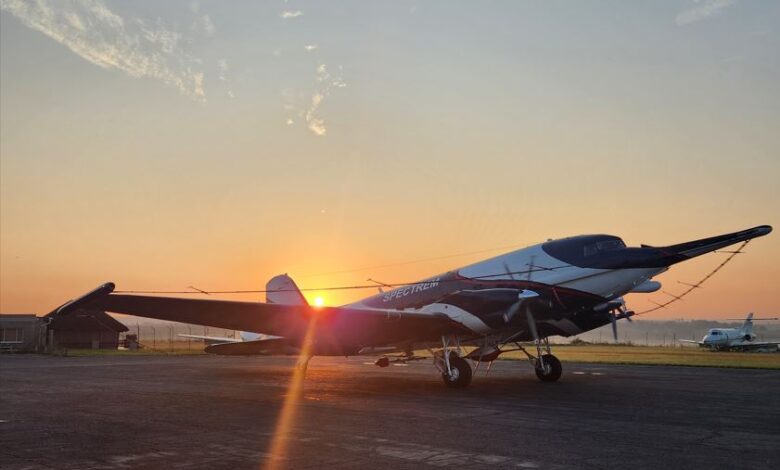
From a technology perspective, Spectrem Air is well-resourced. It has one of the most powerful airborne systems currently available, which delivers increased depth of penetration (800 m below the surface in many Central African areas) and enhanced geological resolution. This is achieved while still maintaining a high level of detail in the near-surface geology.
Enthusiastic
Poised for growth, Spectrem Air is enthusiastic about participating in geological mapping and exploration projects on the continent in 2024. Polome explains that the company hopes to increase its portfolio of successes and, more importantly, play a big role in finding viable mineral deposits.